Research Note
Leveraging Plat Books for FAN Club Research
Plat books are such a fascinating resource, especially when they can be aligned to a census taken around the same time.
Plat books are such a fascinating resource, especially when they can be aligned to a census taken around the same time. The FAN club principle—friends, family, associates, and neighbors—is the simple idea of looking at the people around the research subject to glean more insights about their life.
In the case of Peter King, I have a hypothesis about the specific location of his residence in 1870 using a plat book and a census record. Peter lived in Pleasant Hill, in Sullivan County, Missouri, with Amanda and Melissa and was born in Canada East, today's Québec.
Fortunately, the Edwards Brothers of Missouri published a plat book in 1877 so there is only a seven year gap between the two records. My thought process is that property didn't change ownership frequently at this time and tended to stay in the family. So I'm fairly confident that the residents didn't change dramatically between 1870 and 1877.
It took a while to locate Pleasant Valley. Since Milan is listed as the post office, I started there because it's the county seat. I didn't recognize any of the land owner names on the Milan map as neighbors of Peter. So I found another clue in a Sullivan County history book: settlers in the mid-1800s along Main Locust Creek were Canadians. Jackpot.
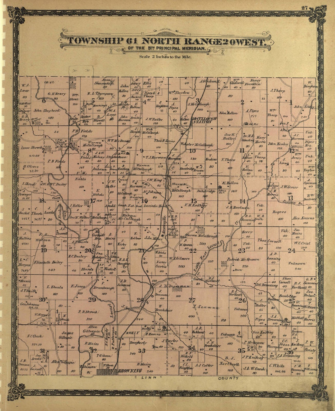
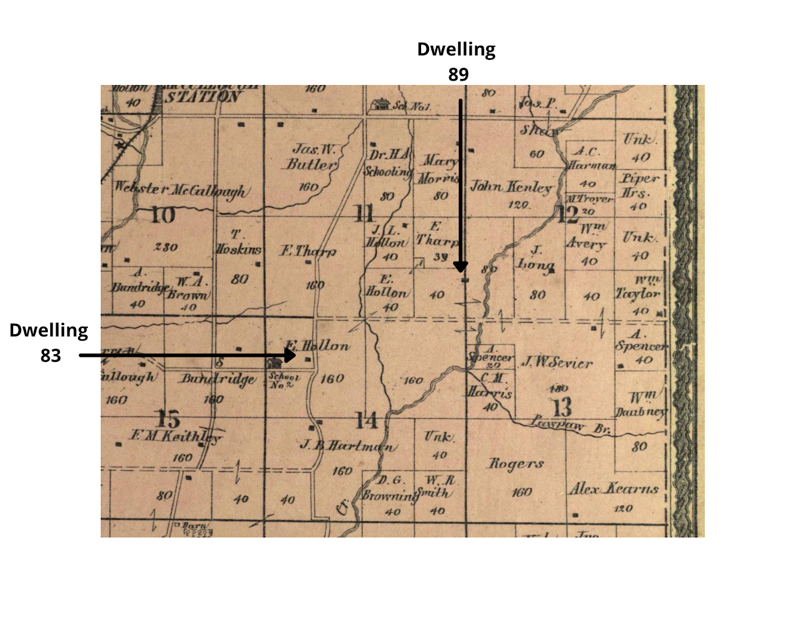
I traced Main Locust Creek south of Milan and began recognizing the names of Peter's neighbors. Here is the full plat map of that area:
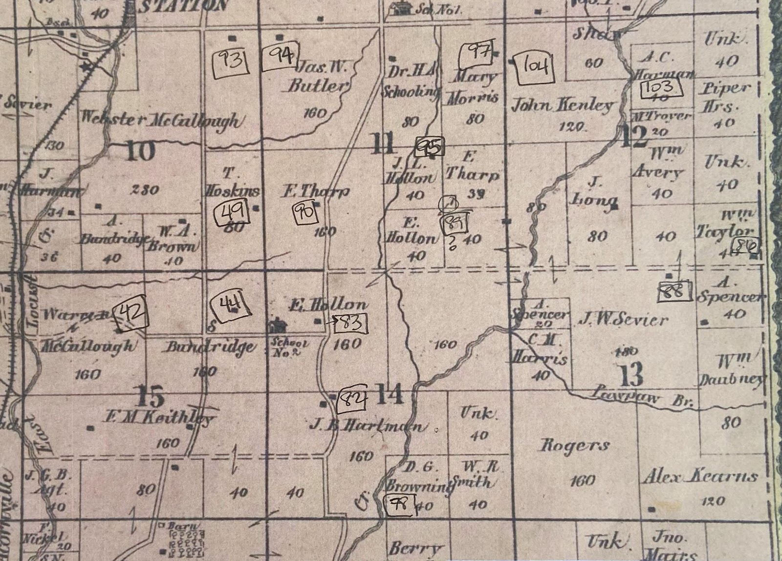
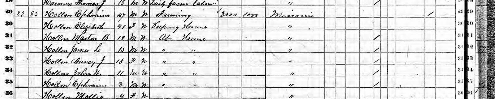
The exciting breakthrough came when I found the property of E. Hollon in sections 11 and 14 above. I believe this land owner is Ephriam Hollon, Amanda's father. The Hollon family was enumerated just a few dwellings away from Peter and Amanda, 83 and 89, respectively.
Here's where the hypothesis is formed. Ephraim had two plots of land diagonally situated. I think there's a strong likelihood that Peter and Amanda lived near Ephraim's smaller piece of land:
This is not definitive proof of Peter and Amanda's residence in 1870. However, there's a lot of evidence that supports they did live very close to this location. Seeing the area of an ancestor's residence makes them feel closer and more real.